Rainbow Loop
Length: 4.4 Miles (Trailhead to Trailhead*) | Difficulty: Moderate
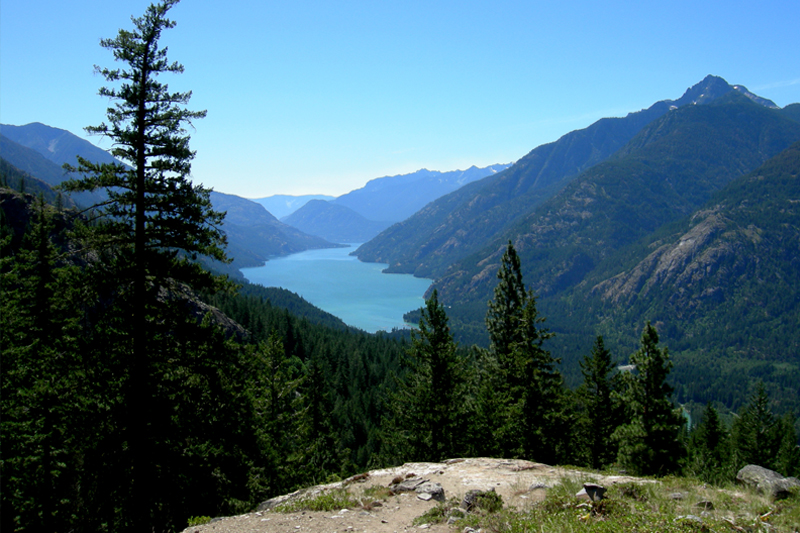
Rainbow Loop Trail is a pleasant 4.4 miles with moderate elevation gains and fantastic views across the entire Stehekin Valley. While technically called a “loop” trail, hikers must utilize an additional 2.4 miles of the Stehekin Valley Road to complete the loop. Most hikers don’t bother with this, and thus will need to be picked up at a different location than where they start. The good news is that this is easy to do with the bus system which services the valley all summer.
PRO TIP: We recommend getting dropped off at the “Upper” trailhead, hiking to the “Lower” trailhead, then walking 1/2 mile down the road to the Stehekin Pastry Co where you can treat yourself to an tasty ice cream cone while you wait for the next bus to pick you up.
We recommend starting at the upper trailhead as the elevation gain is a little less. Also, the first half of the loop is forested, so it is cooler uphill hiking. Two miles will bring you to the junction of Rainbow Loop and Rainbow Creek Trails; here you take a right. (An optional hike is to take a left here up Rainbow Creek Trail a little more than a mile which will take you to an exposed bluff with an excellent 180 degree view of Lake Chelan and the Stehekin Valley.) Continuing right at the junction you will keep you on the Loop Trail, which drops down a short distance to where the trail crosses Rainbow Creek. This is a nice spot for a rest or lunch beside the creek. After climbing up from the creek, the next .4 miles you will be on a flat bench that takes you past Boulder Creek Trail on your left. Stay right and you will start descending into the valley. On the way down there are several nice views of the valley and lake.
PRO TIP: If you do not plan on hiking the whole loop, the lower leg is your best choice for scenery.
To find the trailhead, the easiest thing to do is hop on a bus and tell the driver you want to go to the “Upper (or Lower) Rainbow Loop Trailhead.”
But, if you want to get there on your own, here’s where the 2 trailheads are:
The Lower Trailhead is 2.6 miles from the Stehekin Landing on the main road. (It is 6.4 miles downvalley from Stehekin Valley Ranch.) You will see the sign for it on your right as you head upvalley. It is directly across the street from a cute cabin that says “Rainbow’s End”.
The Upper Trailhead is 5.0 miles from the Stehekin Landing on the main road. (It is 4.0 miles downvalley from Stehekin Valley Ranch.) Again, the trailhead is on the right side of the road as you head upvalley. There is a small pullout across the road from it, but this trailhead is easy to miss if you aren’t watching for it. The sign is a little ways up the hill, but visible from the road if you are looking for it.
*This trail has 2 trailheads which join the Stehekin Valley Road. Most people get dropped off at one trailhead, hike to the second trailhead, then get picked up there. This is 4.4 miles. If you intend to complete the loop by hiking the road between trailheads, the total mileage will be 6.8 miles.


