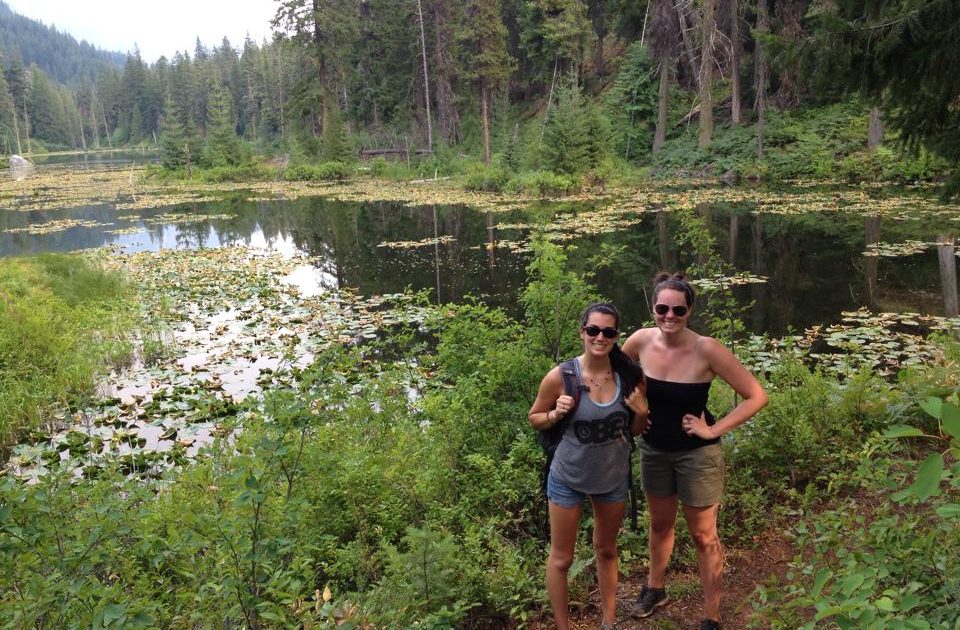
Howard Lake (aka Coon Lake)
Length: 1.0 Miles (2 Miles Round Trip) | Difficulty: Easy-Moderate
Howard Lake is the beginning of the trail to McGregor Mountain, but don’t let that intimidate you. This trail and the surrounding area are full of options to make a great experience for hikers of all skill levels.
Option 1 (The basic hike):
Begin at the High Bridge trailhead found just behind the horse corrals, and hike up via nicely graded switchbacks on your way to the lake. Along the way you can stop at various viewpoints to take in the amazing mountain scenes surrounding you. At 0.4 mi, you will encounter a junction – stay left to continue to the lake. A second junction will appear in another 0.2 mi – again you will want to stay left. At the 1.0 mile point, you will see the lake open up to your right.
Coon Lake is nearly a mile long and rather marshy on the trail end. You will often see wildlife, such as ducks, deer and an occasional beaver on or near the lake.
At this point you may return via the same route for a 2.0 mile hike, or try one (or more) of the following options:
Option 2 (Side trip to some more views):
For those wanting a longer hike, you may continue past the lake and turn right onto the McGregor Mountain Trail. Don’t worry, I’m not sending you clear up a mountain – just a little ways to get some more views. One mile up the McGregor Trail takes you to a nice view of the valley and to a falls which provides a scramble trail to water. The higher you go up the McGregor Trail, the better the view!
Once you have had your fill of the mountain, you can turn around and return to the lake, and then on back to the trailhead.
Option 3 (Hike back to the Ranch):
If you are game for a little longer hike and/or don’t want to coordinate with a bus, you can hike back to the Ranch. The route from the lake to the Ranch is 3.5 miles. Most of this route is via trail, although there is a bit that has been damaged by flooding, and we recommend hiking this short section along the road.
After leaving Howard lake, stay right at the first junction you come to (0.4 mi from Howard Lake), then take a left at the second junction (0.6 mi from Howard Lake).
This is the same trail that is used for horseback rides, so don’t be surprised to see five or six horses. The best thing to do when meeting horses is to step off the trail on the lower side. Try to avoid abrupt movements. A horse will not spook when he sees you if you don’t surprise him. It is best if you let them know you are there, if you are not out in the open, by chatting with the wrangler or guests.
On this route you will soon cross a large rockslide and have good views of the valley and Agnes Creek. Approximately one mile past the main junction, you will come to another junction. Staying left will continue on the trail towards the Ranch, a right will take you to the Stehekin Road. In another 0.5 mi, you will find yet another junction with the same options – left towards the Ranch, right towards the road. However, at this last junction, we recommend you take the RIGHT in order to avoid poorly maintained and flooded trails.
If ever in doubt on your return from the lake, go right – that will take you to the road, which you can follow back to the Ranch.
Option 4 (Make a loop past the lake):
To add a little bit of mileage without elevation gain, you can make a loop past Howard Lake and then back to High Bridge. Continue past the lake, and take a left turn at every junction you encounter. This will take you 1.0 past the lake and join the Stehekin Road at the trailhead for Bridge Creek.
SIDETRIP: While you are this far upvalley, you might want to take a side trip to Carwash Falls – where the road washed out impressively, destroying the road access to the upper parts of the valley. Go right at the road junction until you reach a turnaround where you will see a sign that reads “Road impassible beyond this point”. Step around that sign and carefully continue down to where the road is quite clearly washed out. Then return to the trailhead, and continue down the road towards High Bridge.
If you don’t want to see the washout, head to the left at road and hike 1.5 miles back to High Bridge where you can catch a bus back to the Ranch or town. This section of the road is more primative, and does not get very much traffic. You will also cross Tumwater Bridge which has amazing water features flowing below it. Total mileage for this option is ~3.5 miles.
To find the trailhead, go to High Bridge. The trailhead is located behind the horse corrals there.
Alternatively, you may continue another 1.5 miles past High Bridge, and use the trailhead there. You will essentially be doing Option 4 in reverse, so at every junction you will want to stay right in order to get to Howard Lake and then back to High Bridge.


